Sea Caves at St. Martins, Saint John County


 Focusing upon the letter W for this week gives me an opportunity to post photos of a few beautiful waterfalls I have visited in our province.

.jpg) W is also for winter and below is the same waterfall as the one shown above but in a winter landscape setting.
W is also for winter and below is the same waterfall as the one shown above but in a winter landscape setting..JPG)
My appreciation and thanks to Mrs. Nesbitt's Place for hosting ABC Wednesday. To view more ABC Wednesday posts please click on the link.
 Above: a view from the highway of a ship passing by Saints Rest Marsh, Saint John, NB.
.JPG)
.JPG)
.JPG) North American Railway line was being built between South Bay, NB to the border at St. Croix, NB and Vanceboro, Maine. Built of stone, in the time period before bridges were made of iron and steel, the keystone, seen at the center top of the arch, held the bridge together, making these stone bridges very strong.
North American Railway line was being built between South Bay, NB to the border at St. Croix, NB and Vanceboro, Maine. Built of stone, in the time period before bridges were made of iron and steel, the keystone, seen at the center top of the arch, held the bridge together, making these stone bridges very strong..JPG) I doubt if this beautiful arched bridge is visited often for it was not that easy to access. First we had walked down the railroad tracks but as the top of it is just appears as a flat railroad bed a person could very well not even know it was there, but even though we knew it was there, the embankments were too steep to descend.
I doubt if this beautiful arched bridge is visited often for it was not that easy to access. First we had walked down the railroad tracks but as the top of it is just appears as a flat railroad bed a person could very well not even know it was there, but even though we knew it was there, the embankments were too steep to descend..JPG)
.JPG)

 This photo above was scanned from an older 35mm print taken several years ago.


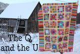
.JPG) U is for unique and there are a couple of features that make this Point Wolfe Covered Bridge so. Covered bridges are no longer being built for New Brusnwick highways but this one at Fundy National Park in Albert County was built in 1992. This was an exception as this bridge was built to replace a previous one that was an historical landmark and had been destroyed by a construction accident in 1990. Also this covered bridge is red and I think it might be the only one that has been painted.
U is for unique and there are a couple of features that make this Point Wolfe Covered Bridge so. Covered bridges are no longer being built for New Brusnwick highways but this one at Fundy National Park in Albert County was built in 1992. This was an exception as this bridge was built to replace a previous one that was an historical landmark and had been destroyed by a construction accident in 1990. Also this covered bridge is red and I think it might be the only one that has been painted.